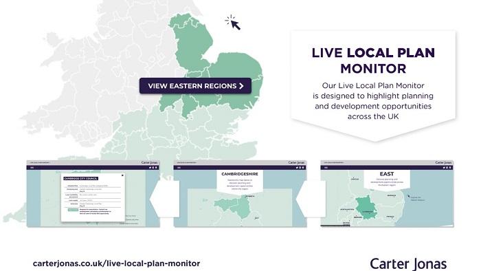
The web-based resource is unique in providing an up-to-date snapshot of local planning which will create a level of insight not previously available. It does this through a series of interactive web pages displaying local authority boundaries, key towns and cities and road networks in the context of information on the adopted local plan, emerging local plans (and the regulation stage reached), stated housing land supply and opportunities for submitting sites for development suitability assessment.
The tool is intended for use by developers, landowners, Central Government, those responsible for major infrastructure projects, Government bodies (eg, Environment Agency, Natural England), local authorities and members of the public.
Colin Brown Head of Planning & Development Division and of the Cambridge office, commented: “We are very pleased to increase the roll-out of our Live Local Plan Monitor to now cover London and the East of England. We have had excellent feedback from clients in those parts of the country where our monitor is already active and so extending it to will provide further up-to-date information for all of our clients and professional contacts. As clients consider their landholdings and development opportunities, being on top of the latest position with Local Plans is of crucial importance, particularly at a time when the Government is seeking to implement major changes to the planning system.”
With the microsite for the South and South West launched in November, London and the Eastern Region were launched last week. The North and Midlands are due in early May, so the national picture will be complete shortly.